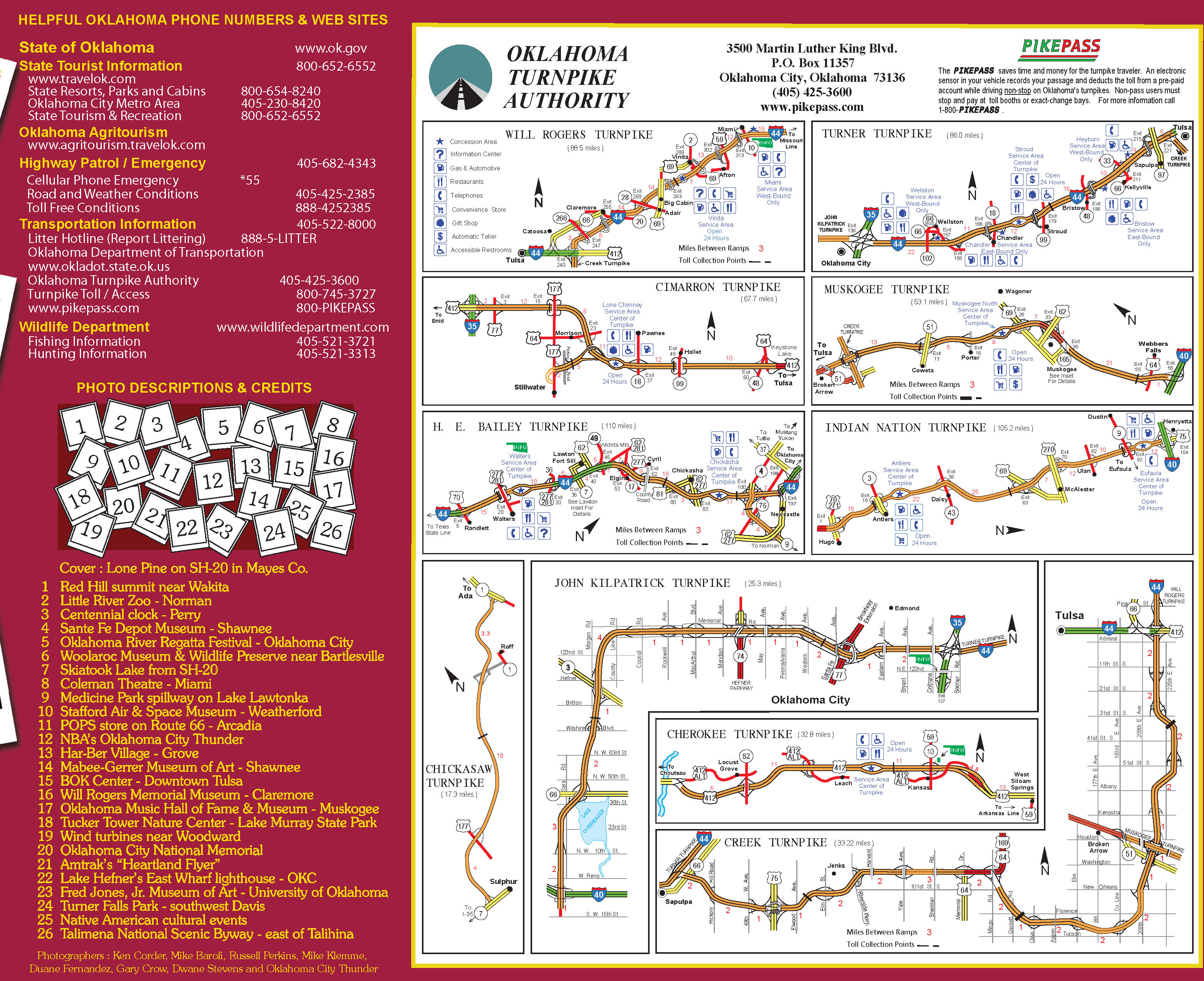
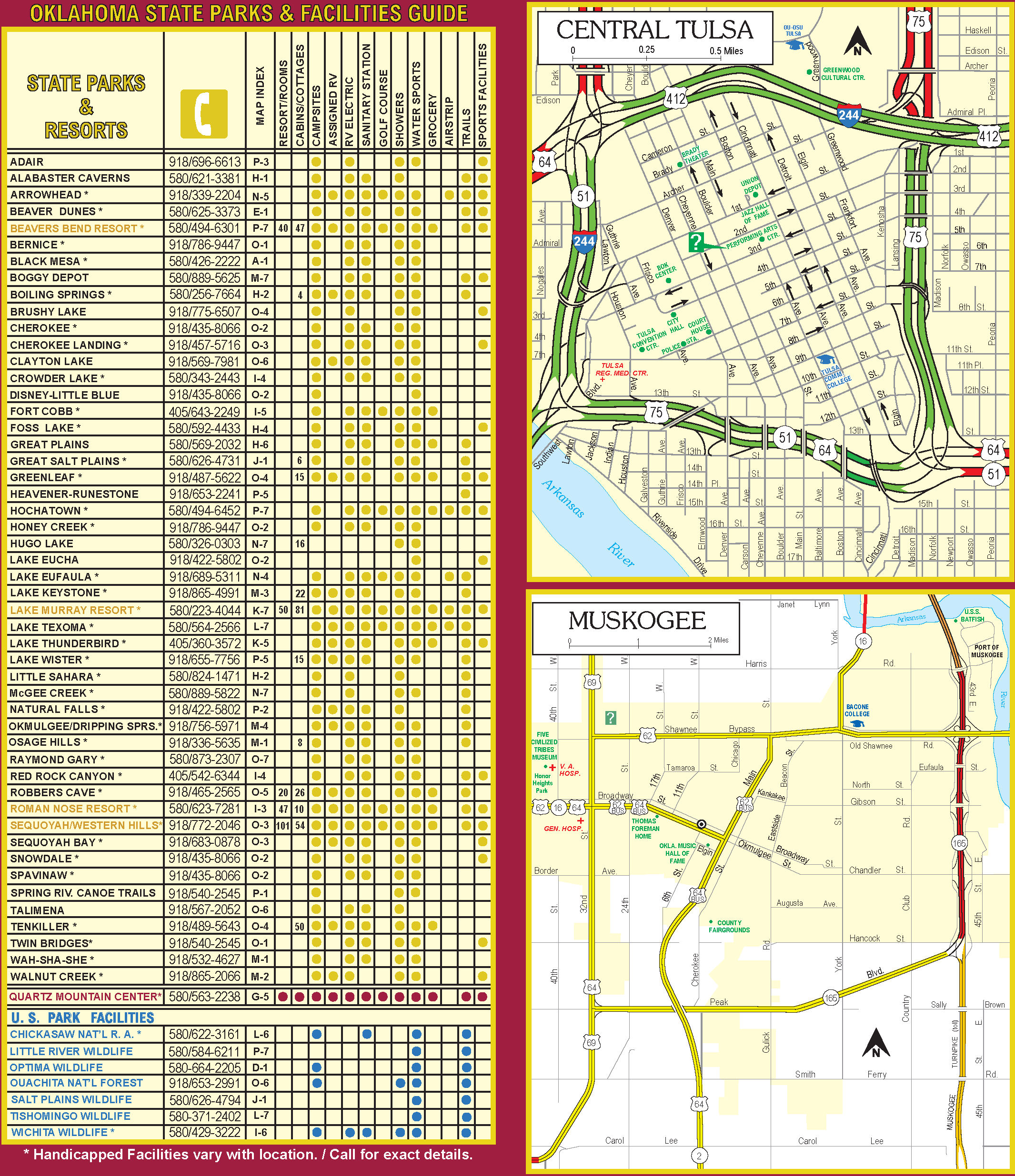
HOMEHighway InformationMapsState Highway Map
Contact Planning & Research

Please Note: Unless otherwise noted, presented
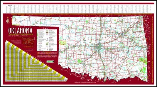
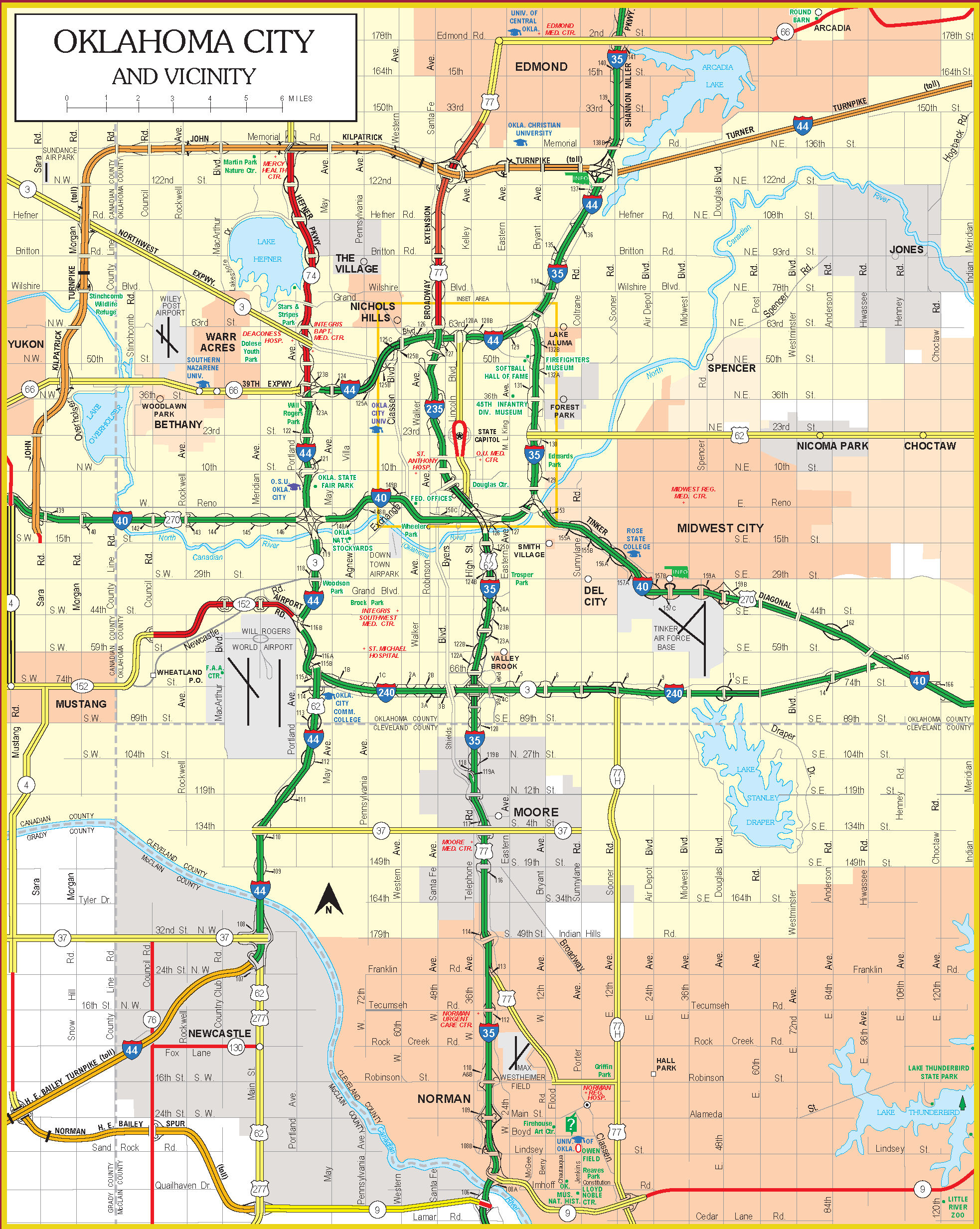
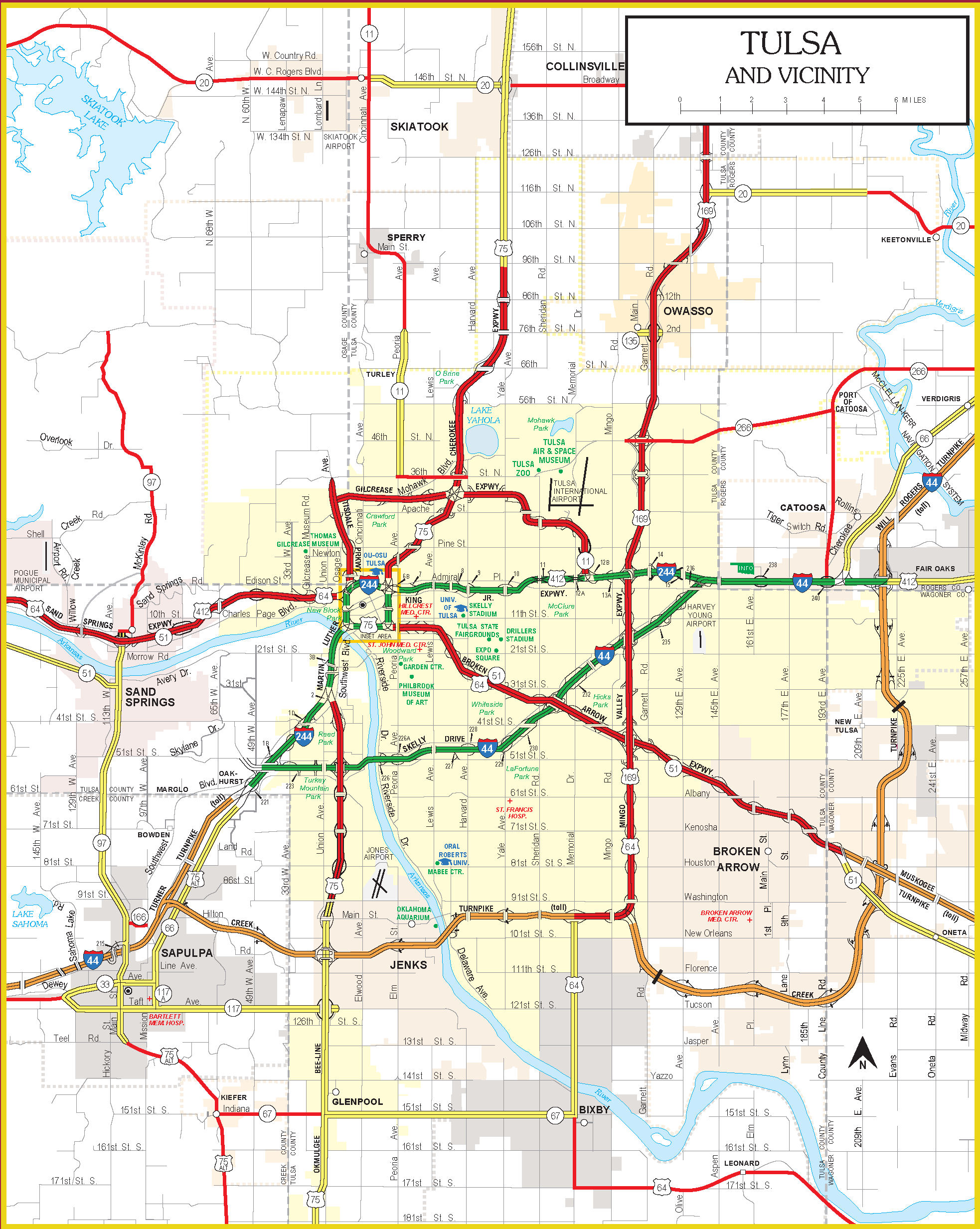
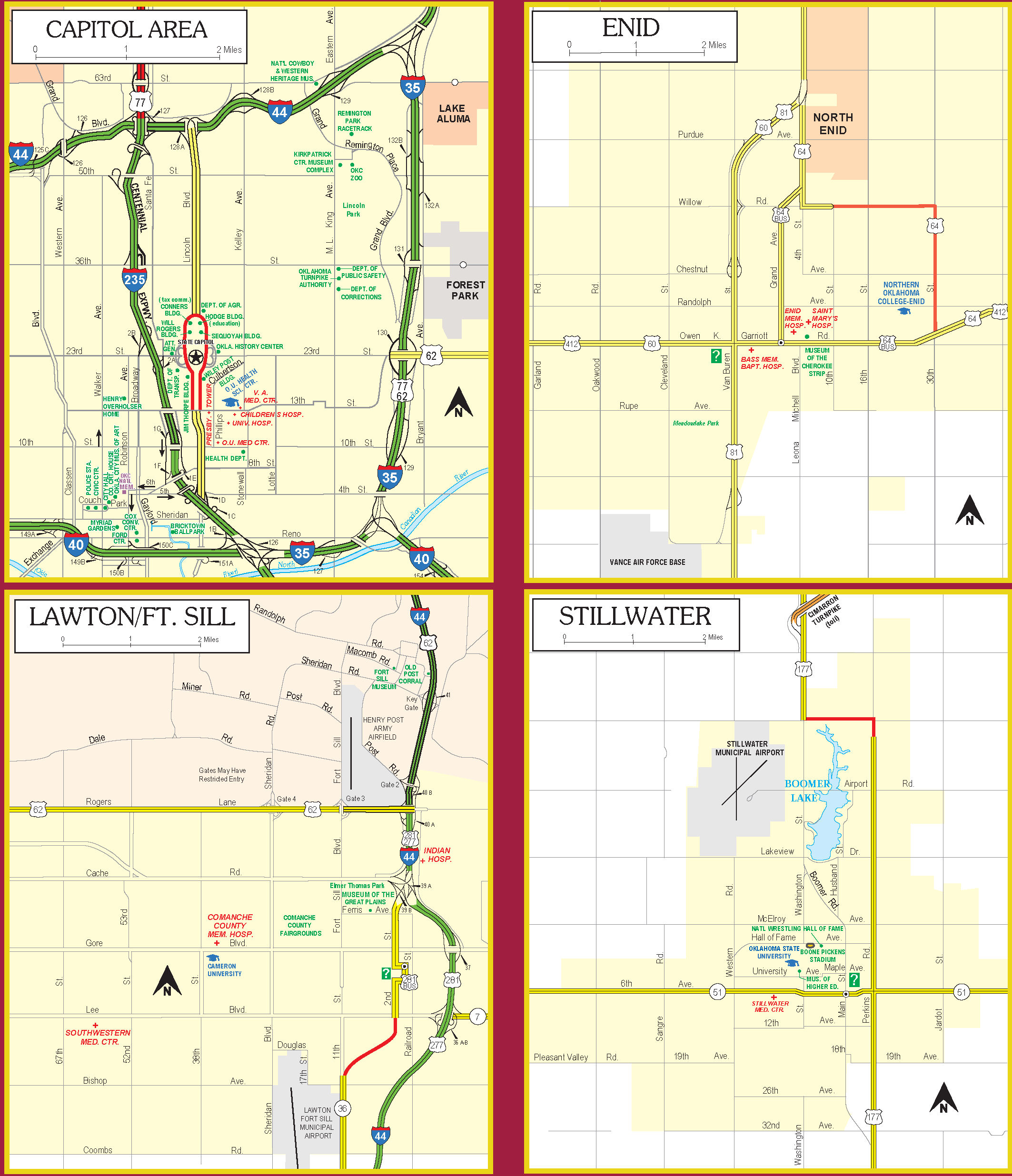
media is restricted for viewing and printing only.

The State Map and Back Cover are in pdf format.
Others are in jpg format. Zooming in on the jpg will present a clearer image.
Click on the images below to open the associated files.

   •• Request the State Map ••


Your Turn To Venture
2009 State Highway Map

Map Cover


State Map
State Highway Map


State Map Insets
Oklahoma City Map
Oklahoma City
Governor's Message
Governor's Message
Tulsa Map
Tulsa

Capitol, Enid,Lawton/Ft. Sill & Stillwater Maps
Capitol, Enid,
Lawton/Ft. Sill & Stillwater
Helpful Phone Numbers, Web Sites, Photo Descriptions & Turnpike Map
Helpful Phone Numbers, Web Sites,
Photo Descriptions & Turnpikes
Central Tulsa, Muskogee Maps Inset & State Parks
State Parks
Central Tulsa & Muskogee


Artwork
Due to copyright the Artwork and Back Cover is limited to viewing only.
Artwork


Back Cover
Back Cover


HOMEHighway InformationMapsState Highway Map
BACK TO TOP